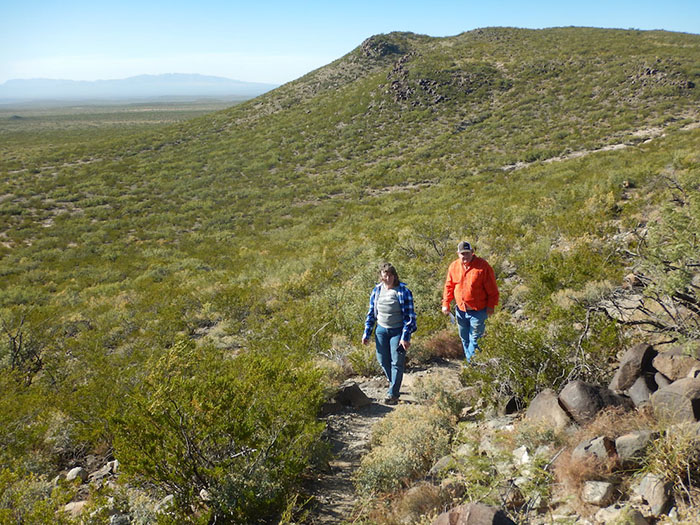
Hikers at Three Rivers Petroglyph Site are constantly on the lookout for ancient native carvings; image by Tom Adkinson. |
THREE RIVERS, New Mexico – This dot on the New Mexico roadmap is your gateway to an unexpected outdoor art garden a mile high in the Chihuahuan Desert. Five miles down a bumpy road off U.S. 54 is Three Rivers Petroglyph Site, which harbors more than 21,000 carefully chronicled rock carvings.
The native Jornada Mogollon (pronounced hor-NAH-da muggy-OWN) people were the artists. They left their marks on the landscape between 900 and 1400 A.D. and then disappeared – gone forever by the time Spanish explorers began poking around the Southwest in the 1500s. They have no known descendants.
Their canvas was an abundance of basalt, a volcanic rock, on which they etched images of masks, humans, sheep, lizards, handprints, insects, plants, geometric designs and fish.
You might wonder how the Jornada Mogollon even knew what a fish looked like, considering today’s desert landscape, but they were an agricultural people, and there obviously was more water in the region hundreds of years ago. Even today, locals mention Indian Creek, Swallow Creek and Three Rivers, although you won’t find year-round flowing streams.
Most of the site’s petroglyphs are along a basalt ridge where a trail makes it easy to find them. The site has picnic and camping facilities, and a trail map is available at the welcome center building. The map leads you to numbered locations and has photos explaining specific petroglyphs.
This arrow-pierced bighorn sheep is directly along the trail at Three Rivers Petroglyph Site; image by Tom Adkinson. |
No. 7 on the map is probably the best known and most photographed location. It clearly shows the body of a bighorn sheep, itself decorated with a geometric design, and pierced by three arrows. No. 8 is an example of a mask positioned into the rock and appearing three-dimensional. No. 9 is a human face with almond-shaped eyes and dangling earrings.
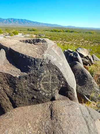
Desert lizards might not have sat still for native artists to carve, but their outlines were carve from memory; image by Tom Adkinson. |
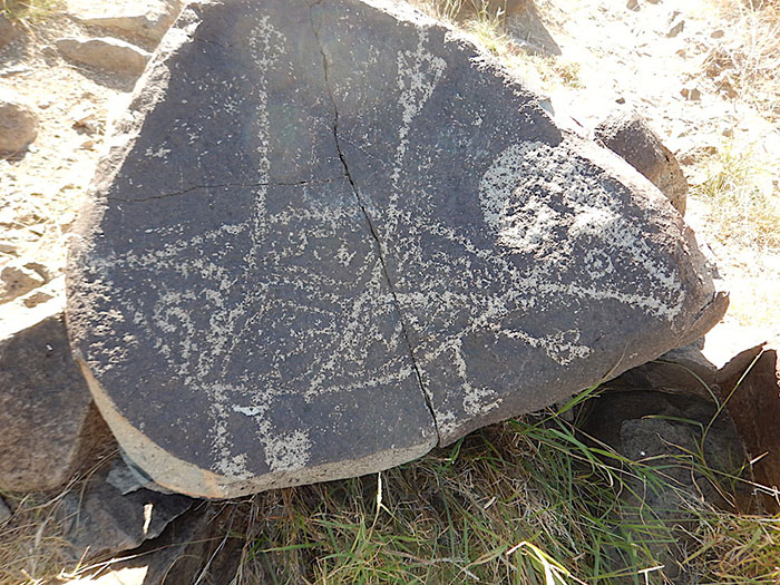
A ridge of the Sacramento Mountains rises across the scrubland from a geometric petroglyph; image by Tom Adkinson. |
The trail covers about 1.5 miles and is an out-and-back route. One section on the return takes you slightly lower on the ridge and exposes a variety of petroglyphs, particularly in the afternoon sunshine. The Jornada Mogollon artists had good light as they used stone tools to scrape away the desert varnish (a thin layer of manganese oxide, iron oxide and clay) and leave their designs.
The entire site is relatively flat terrain at about 5,000 feet elevation, and while the trail gains only about 80 feet, it provides excellent perspectives on the surrounding territory.
If you look west about 30 miles, it’s possible to spy a corner of the glistening gypsum dunes of White Sands National Monument, while the view to the east is of the Lincoln National Forest’s White Mountain Wilderness, the Mescalero Apache Indian Reservation and Sierra Blanca in the Sacramento Mountains. At almost 12,000 feet, Sierra Blanca is 7,000 feet higher than where you’re standing on the petroglyph trail.
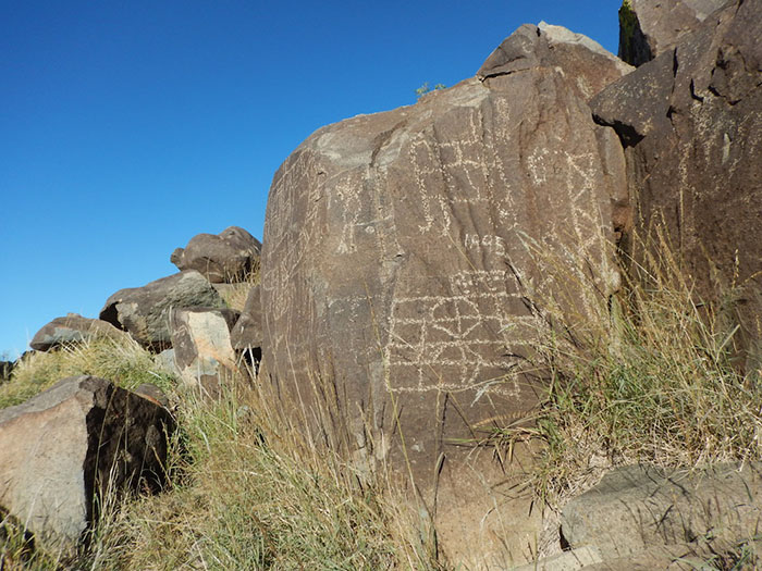
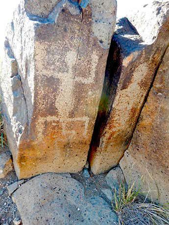
This flat rock face practically became a billboard for various artists, probably including a latter-day ranch hand who added “1895” to the collection; image by Tom Adkinson. |
Three Rivers Petroglyph Site is a compact square five miles on each side, and a majority of its artwork is along the trail in an area covering about 50 acres. This was open ranchland before it came under Bureau of Land Management protection, and you may notice some carvings that look newer than those of the natives. A clear “1895” on one rock face is an example.
A short walk the opposite direction from the petroglyph trail leads to a Jornada Mogollon village site. You can see evidence of archeological excavation work done there in 1976.
Three Rivers Petroglyph Site is about 100 miles northeast of Las Cruces and 40 miles north of Alamogordo. The entrance to White Sands National Monument is between Las Cruces and Alamogordo. So it’s possible to go dune sledding and petroglyph hiking the same day.
Trip-planning resources: NewMexico.org, BLM.gov, Alamogordo.com and LasCrucesCVB.org
(Travel writer Tom Adkinson’s new book, 100 Things To Do in Nashville Before You Die, is available at CornersOfTheCountry.com.)
