| |
Chapman Highway transformation plans finalized
KNOXVILLE - A report which summarizes the city's Chapman Highway Implementation Plan has been completed.
“This final report is not ‘just another study,’ but instead its purpose is to function as an implementation plan that provides a prioritized list of implementable projects to transform and improve Chapman Highway,” the report states.
The report, was prepared on behalf of the City of Knoxville. The study included a six-mile section of Chapman Highway within the city limits, between Blount Avenue (near Henley Bridge) and Mountain Grove Drive (just south of Gov. John Sevier Highway). It combines traffic data with extensive input from stakeholders in recommending priorities for safety improvements along the state route.
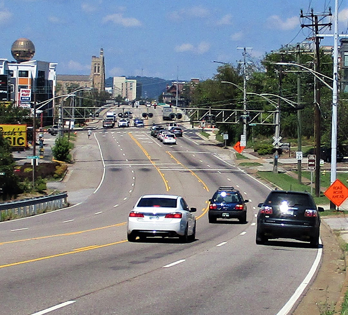
Chapman Highway approaching Henley Street Bridge; image courtesy of the City of Knoxville
|
“The Transportation Planning Organization team that managed this initiative worked very hard to welcome and incorporate input from people who drive Chapman Highway every day,” Knoxville Mayor Madeline Rogero said.
“This report blended together more than 500 comments from an online survey, conversations with over 280 people who attended community workshops, feedback from four steering committee meetings and two stakeholder meetings, and technical expertise and data from traffic engineers. The research and dialogue were thorough, and the final report is comprehensive.”
The report calls on the City of Knoxville and other funding partners to strategically collaborate and look for opportunities to combine different smaller projects to maximize efficiency.
As a state highway, improvements to Chapman Highway require partnership with the Tennessee Department of Transportation and are subject to TDOT approval. The City of Knoxville has worked with TDOT and invested local funds to improve key points along the Chapman Highway corridor, but a broader approach to making the entire road safer will require resources beyond those available to local government acting alone.
The City will be actively pursuing funding for projects prioritized in the Implementation Plan and will be engaging with TDOT as the state determines specific projects that will be funded through $45 million in state IMPROVE Act funds. The IMPROVE Act will fund projects on a 10.3-mile section of Chapman Highway between Blount Avenue and Seymour.
In the Chapman Highway Implementation Plan, 47 projects were analyzed and assigned a numerical score, based on community input and technical data.
As anticipated, safety for all commuters factored heavily in setting priorities. Creating center turn lanes or medians in all sections of Chapman Highway is a primary focus.
Projects that add center turn lanes or medians, as well as several bike and pedestrian improvement projects, were among the 12 projects listed below that were scored as the highest priorities:
• Maryville Pike and Martin Mill Pike – study alternatives, possibly realigning or consolidating the two intersections (157 points)
• Stone Road – construct left-turn lanes (144 points)
• Lakeview Drive to Chapman Ford Crossing – widen for a center left-turn lane or landscaped median (140 points)
• Nixon Road to Mountain Grove Drive – maintain a center left-turn lane or convert to a landscaped median (139 points)
• Overbrook Drive to Lakeview Drive – widen for a center left-turn lane or landscaped median (136 points)
• Chapman Ford Crossing to Nixon Road – widen for a center left-turn lane or landscaped median (132 points)
• Blount Avenue to Fort Dickerson Road – provide landscaped buffer, separated bike lanes and sidewalks (132 points)
• Between Moody Avenue and Young High Pike – transit super stop, for improved transfers (132 points)
• Blount Avenue to Fort Dickerson Road – widen for landscaped median (123 points)
• Fort Dickerson Road to Moody Avenue – provide landscaped buffer, separated bike lanes and sidewalks (121 points)
• Moody Avenue to Young High Pike – provide landscaped buffer, separated bike lanes and sidewalks (121 points)
• Young High Pike to Overbrook Drive – provide landscaped buffer, sidewalk and shared use trail (115 points)
A number of City-funded Chapman Highway improvements have been made or are nearing completion. Recent improvements include:
• Realignment of the Fort Dickerson Park intersection with improvements to signals and pedestrian crossing facilities (completed in 2015 at a cost of $1 million);
• Sidewalk construction on Young High Pike, including pedestrian facility improvements at the intersection with Chapman Highway (completed 2017; $260,000);
• A reconfiguration of the Chapman Highway intersection with Blount Avenue, with sidewalk and crosswalk improvements, part of the Blount Avenue Streetscapes Project (to be completed in fall 2019; $300,000 for signal improvements);
• Signalization improvement for the entire Chapman corridor (project cost estimated at $2 million – currently in the right-of-way acquisition and utility coordination phase);
• Collaboration with the Tennessee Department of Transportation to improve bicycle/pedestrian infrastructure on Chapman Highway by creating 3,200 feet of greenway between Stone Road and Woodlawn Pike and 525 feet of sidewalk from Woodlawn Pike to the existing sidewalk near Young High Pike; this project will also create pedestrian crossings at three intersections (Stone Road, Fronda Lane and Woodlawn Pike) and improve four Knoxville Area Transit bus stops (state grant, $950,000; City funding, $858,000); and
• Completion of a concept plan for bike and pedestrian improvements from Henley Bridge to Lippencott Street.
Published September 6, 2019 |
