| |
Take a break from the interstate to hike beside Tennessee’s Burgess Falls
By Tom Adkinson
March 11, 2022
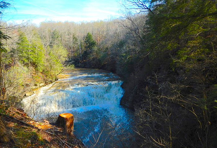
A rain-swollen Falling Water River roars over one of four drops at Burgess Falls State Park and Natural Area. Image by Tom Adkinson |
SPARTA, Tennessee – The Falling Water River on Tennessee’s Cumberland Plateau comes by its name honestly.
Want proof? There’s a well-worn trail in Burgess Falls State Park and Natural Area that takes you beside four waterfalls in less than a mile. They start with an impressive 20-foot-tall cascade and then rapidly gain size – first with a 30-foot drop, then with an 80-foot drop and finally with the big one that measures 136 feet.
These spectacles of nature and gravity are only a 10-mile side trip off of I-40 south of Cookeville and offer a refreshing break on a cross-state drive.
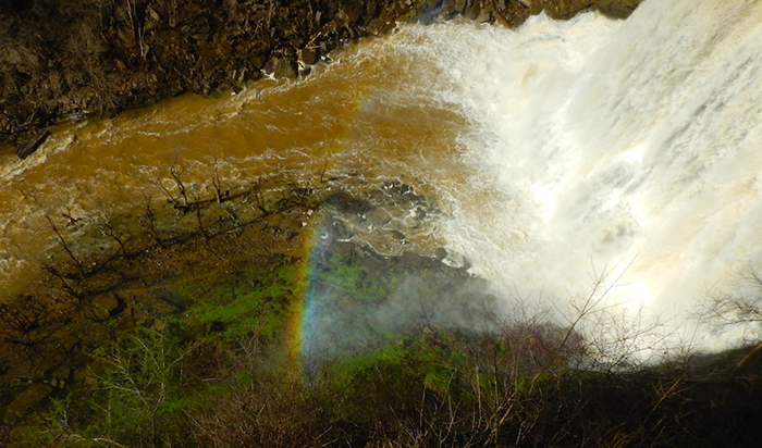
The hint of a rainbow emerges in the mist below one of the waterfalls at Burgess Falls State Park and Natural Area. Image by Tom Adkinson |
As you stroll along the River Trail, you’ll see two warning signs, which seem unnecessary, although not everyone is as cautious as you are. One counsels “No Swimming.” The other is strategically placed and declares, “DANGER. DO NOT GO BEYOND THIS POINT.”
The park describes the River Trail as difficult/strenuous, but it’s still one that families enjoy. Most hikers walk on the well-trod natural-surface to view the waterfalls and then return to their vehicles on a shaded park service road. The round trip is 1.5 miles.
The nearby Ridge Top Trail is a scenic 1-mile walk that offers views down the main canyon on the Falling Water River.
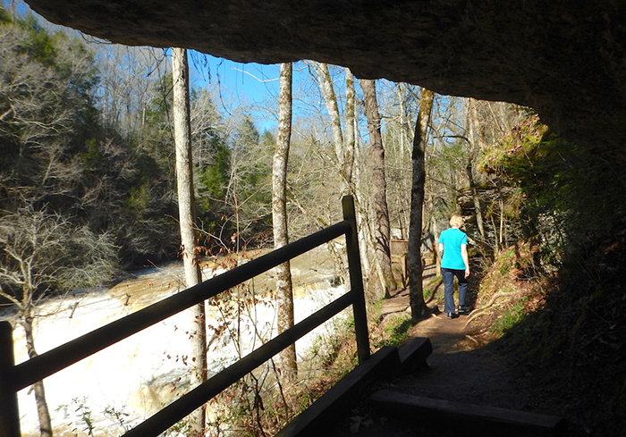
A rock overhang protects a short piece of the River Trail. The loop trail covers 1.5 miles. Image by Tom Adkinson |
Native Americans – Chickasaws, Cherokees and Creeks – knew this region and hunted here until the encroachment of settlers in the 1800s. The Cumberland Plateau may not have been the best of Tennessee’s farmland, but the river was a power source for gristmill and sawmill operations.
Later on, the dramatic drop in elevation led to installation of hydroelectric generators that sent electricity to Cookeville, long before the Tennessee Valley Authority came into existence. That power generation lasted from 1928-1944.
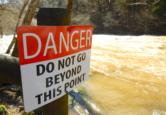
“No problem understanding that message” is how most people interpret this sign along the River Trail. Image by Tom Adkinson |
The ingenuity involved in the electricity generation was amazing. Engineers built a dam above the waterfalls and steered water into a pipeline built of western cedar boards held together with iron bands, but that was only part of the process.
Two bridges had to be built to suspend the pipeline above the river, and then the pipeline had to be routed through a tunnel dug through a limestone ridge. If you know what to look for as you walk along the River Trail, you can see remnants of the pipeline bridges and some stone and concrete foundations that cradled the pipeline in other locations.
The region’s geology is explained in a park display. The oldest rock in the park was formed upwards of 450 million years ago from the deposits of an inland ocean. Successive geologic ages produced more layers of limestone and shale and conditions that allowed erosion to carve routes that visitors enjoy today as waterfalls.
A very special view of Burgess Falls is from below, and the way to see that is on a kayak tour. A calendar on the park’s website promotes tour dates. Reservations are required for the 3.5-hour outings, and the fee is $30.

The Happy Trails Taproom in Sparta is a destination many area hikers seek in Tennessee’s Upper Cumberland region. Image by Tom Adkinson |
Burgess Falls State Park is between Cookeville and Sparta, and if you’d prefer to bend an elbow by lifting a craft beer instead of paddling a kayak, drive another 10 miles to Sparta and find the Happy Trails Taproom. It’s popular with area hikers and notable because owner Jessica Upchurch left a career in elementary education to become a brewmaster.
|
